Filtering results
Shell
# projected CRSs only
projpicker 34.2348,-83.8677 33.7490,-84.3880 | grep "^projected_crs"

# CRSs in meter only
projpicker 34.2348,-83.8677 33.7490,-84.3880 | grep "|meter|"
Python
import projpicker as ppik

# sorted by area to find the most local CRS first
bbox = ppik.query_points([[34.2348, -83.8677], [33.7490, -84.3880]])

# projected CRSs only
bbox_proj = list(filter(lambda x: x.proj_table=="projected_crs", bbox))
ppik.print_bbox(bbox_proj)

# CRSs in meter only
bbox_meter = list(filter(lambda x: x.unit=="meter", bbox))
ppik.print_bbox(bbox_meter)
GUI
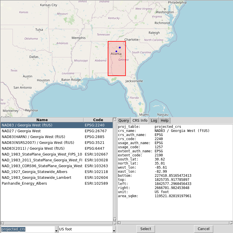
GUI for selecting a subset of queried results
Shell
The -g (--gui) option launches a tkinter-based GUI for selecting a subset of queried results.
Geometries and other options still need to be passed from the command line:
# projected CRSs only
projpicker -g 34.2348,-83.8677 33.7490,-84.3880
Python
import projpicker as ppik

bbox = ppik.query_points([[34.2348, -83.8677], [33.7490, -84.3880]])

# start GUI
bbox, *_ = ppik.gui.start(bbox)